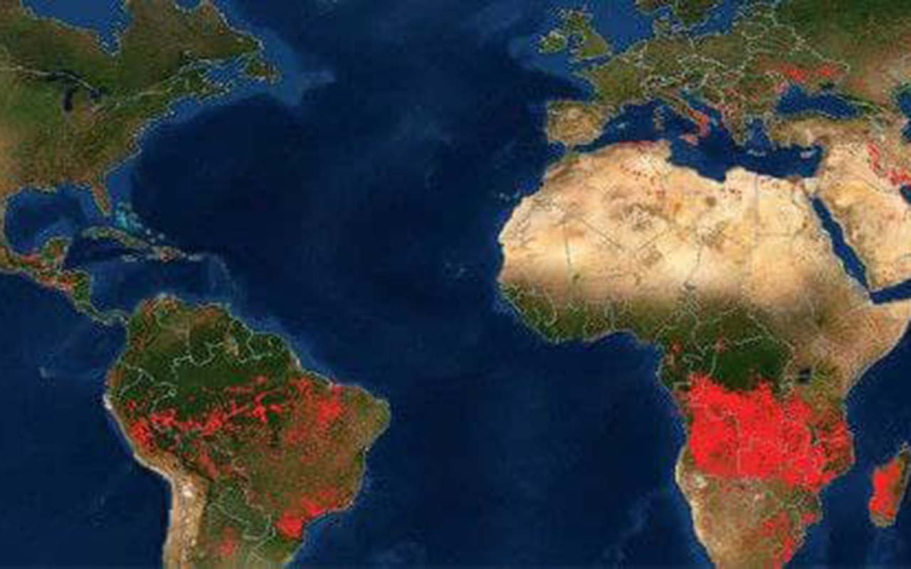
NASA showed a map of the fires, visible from space. The organization showed that 5 out of 6 continents are affected by fires.
The National Aeronautics and Space Administration, in the United States, showed a view of the continents from space. In particular, the places of ignition are noticeable. Although some red dots are volcanic eruptions or torches of fire in gas fields, most are forest fires.
The map shows that Africa, the States, Russia, Australia are suffering from the fires. This is visible from space.
The world is suffering from fires – they cover ever large territories in different parts of the world. According to experts, the season of fires is far from over. Fires have engulfed regions of the United States, Canada, Russia and the Mediterranean Sea.
In Greece, as of August 10, due to fires, they announced the evacuation of people from 12 settlements on the administrative borders of Elis-Arcadia. Also in Greece, fires raged in the Attica region, on the island of Evia, near Athens. Before that, a record +46 degrees were recorded in the country.
In Portugal and Spain, temperatures are also expected to rise to 40 degrees. Therefore, the authorities of the countries are taking measures to prevent forest fires.
In August, forest fires broke out in the USA, Montenegro, Russia, Algeria, Turkey, Albania, Croatia.